Jump to navigation
Home
Browse
About
Contact Us
Navigating & Searching
Partner Information
Login
Search Term
Advanced Search
You are here
Home
›
lake country museum
(x)
›
info:fedora/islandora:compoundCModel
(x)
›
Search results
Search results
Search Results
Displaying (1 - 20 of 52)
Pages
1
2
3
next ›
last »
Title
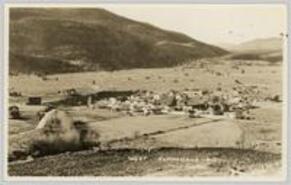
[Lower Town]
Date
1913
Is Part of
Summerland Museum and Archives Postcard Collection
Source
Summerland Museum and Archives
Local Identifer
1992_021_001
PID
summer:496
Title
War Canoes off Lower Summerland
Date
1906
Is Part of
Summerland Museum and Archives Postcard Collection
Source
Summerland Museum and Archives
Local Identifer
1984_412_005
PID
summer:490
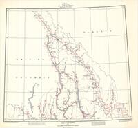
Title
[Kaslo-Slocan District, Box Lake-Rosebery Road retaining wall at Rosebery]
Date
1930
Is Part of
Silver Slocan Historical Society Map Collection
Source
Silvery Slocan Historical Society
Local Identifer
8.9
PID
sshs:2516
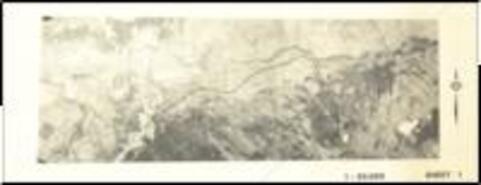
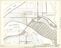
Title
Riparian-zone Technical Maps of Columbia River Valley
Date
1951-1958
Is Part of
Revelstoke Museum & Archives Maps, Plans & Drawings
Source
Revelstoke Museum & Archives
Local Identifer
A2004.078.000
PID
revelstoke:26312
Title
[Lower Town - Looking South]
Date
1910
Is Part of
Summerland Museum and Archives Postcard Collection
Source
Summerland Museum and Archives
Local Identifer
1978_193_008
PID
summer:484
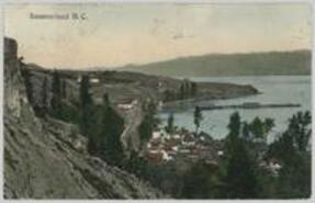
Title
Summerland, B.C.
Date
1908
Is Part of
Summerland Museum and Archives Postcard Collection
Source
Summerland Museum and Archives
Local Identifer
1978_081_001
PID
summer:453
Title
[S.S. Okanagan leaving T.J. Smith Wharf]
Date
1923
Is Part of
Summerland Museum and Archives Postcard Collection
Source
Summerland Museum and Archives
Local Identifer
1992_054_001
PID
summer:499
Title
Merritt to Peachland Highway
Date
1985
Is Part of
Peachland Museum Map Collection
Source
Peachland Museum
Local Identifer
PEAC_13_03
PID
peach:1048
Title
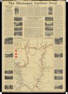
1926 Road Map: The Okanogan-Cariboo Trail
Date
1926
Is Part of
Summerland Museum and Archives Map Collection
Source
Summerland Museum and Archives
PID
summer:2783
Title
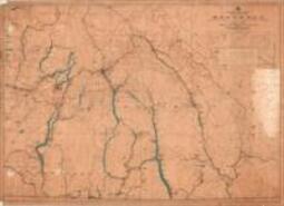
Kootenay Osoyoos & Similkameen
Date
1930
Is Part of
Revelstoke Museum & Archives Maps, Plans & Drawings
Source
Revelstoke Museum & Archives
Local Identifer
A1971.002.005
PID
revelstoke:26230
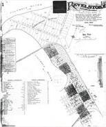
Title
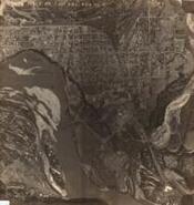
Aerial photographs of Revelstoke
Date
1965
Is Part of
Revelstoke Museum & Archives Maps, Plans & Drawings
Source
Revelstoke Museum & Archives
Local Identifer
A2002.004.015
PID
revelstoke:26233
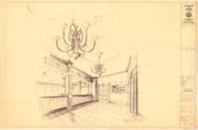
Title
Plans for Imperial Bank of Canada, Revelstoke, B.C.
Date
1902
Is Part of
Revelstoke Museum & Archives Maps, Plans & Drawings
Source
Revelstoke Museum & Archives
Local Identifer
A2002.004.026
PID
revelstoke:26240
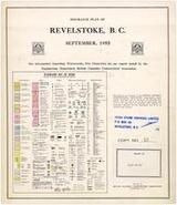
Title
Insurance plan of Revelstoke, B.C.
Date
1955
Is Part of
Revelstoke Museum & Archives Maps, Plans & Drawings
Source
Revelstoke Museum & Archives
Local Identifer
A2004.028.000
PID
revelstoke:26257
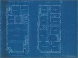
Title
Insurance map of Revelstoke in 13 sections
Date
1905
Is Part of
Revelstoke Museum & Archives Maps, Plans & Drawings
Source
Revelstoke Museum & Archives
Local Identifer
A2004.028.001
PID
revelstoke:26272
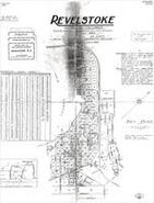
Title
Fire insurance map of Revelstoke with multiple revisions
Date
1932-1948
Is Part of
Revelstoke Museum & Archives Maps, Plans & Drawings
Source
Revelstoke Museum & Archives
Local Identifer
A2004.028.002
PID
revelstoke:26285
Title
Plans for restoration of Revelstoke Courthouse
Date
1974-1977
Is Part of
Revelstoke Museum & Archives Maps, Plans & Drawings
Source
Revelstoke Museum & Archives
Local Identifer
A2004.077.000
PID
revelstoke:26292
Title
Plans of Courthouse at Revelstoke
Date
1910-1911
Is Part of
Revelstoke Museum & Archives Maps, Plans & Drawings
Source
Revelstoke Museum & Archives
Local Identifer
A2004.077.001
PID
revelstoke:26305
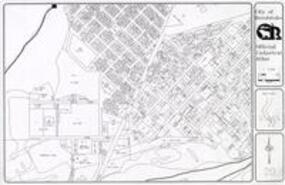
Title
City of Revelstoke official Cadastral Atlas
Date
2000
Is Part of
Revelstoke Museum & Archives Maps, Plans & Drawings
Source
Revelstoke Museum & Archives
Local Identifer
A2016.084.000
PID
revelstoke:26315
Title
Revelstoke Composite Maps C82 Series Nelson Land Registration District, Kootenay Land District
Date
1962-1967
Is Part of
Revelstoke Museum & Archives Maps, Plans & Drawings
Source
Revelstoke Museum & Archives
Local Identifer
A2016.097.000
PID
revelstoke:26320
Title
West Summerland
Date
1938
Is Part of
Summerland Museum and Archives Postcard Collection
Source
Summerland Museum and Archives
Local Identifer
1978_139_001
PID
summer:456
Pages
1
2
3
next ›
last »

![[Lower Town]](https://bcrdh.ca/sites/bcrdh.ca/files/styles/islandora_imagecache_image_style_medium/public/externals/a2e04a9479e48eec09f2bcd5b2d24551.jpg?itok=qeEKb0wd&pid=summer:496&iic=true&solr_nav%5Bid%5D=99c0dec25a1d1d411a20&solr_nav%5Bpage%5D=0&solr_nav%5Boffset%5D=0)
![[Kaslo-Slocan District, Box Lake-Rosebery Road retaining wall at Rosebery]](https://bcrdh.ca/sites/bcrdh.ca/files/styles/islandora_imagecache_image_style_medium/public/externals/29fdb02ac0f9cf8d6bbeddf411657687.jpg?itok=7iplxZjt&pid=sshs:2516&iic=true&solr_nav%5Bid%5D=99c0dec25a1d1d411a20&solr_nav%5Bpage%5D=0&solr_nav%5Boffset%5D=2)
![[Lower Town - Looking South]](https://bcrdh.ca/sites/bcrdh.ca/files/styles/islandora_imagecache_image_style_medium/public/externals/a4c7e732308cf9a9b79544014e9580c8.jpg?itok=UeQvnNJW&pid=summer:484&iic=true&solr_nav%5Bid%5D=99c0dec25a1d1d411a20&solr_nav%5Bpage%5D=0&solr_nav%5Boffset%5D=4)
![[S.S. Okanagan leaving T.J. Smith Wharf]](https://bcrdh.ca/sites/bcrdh.ca/files/styles/islandora_imagecache_image_style_medium/public/externals/e90ec21de3c9f16b4ced5922796634d2.jpg?itok=zcs_D_Vs&pid=summer:499&iic=true&solr_nav%5Bid%5D=99c0dec25a1d1d411a20&solr_nav%5Bpage%5D=0&solr_nav%5Boffset%5D=6)