Search results

Search Results
Displaying (1 - 20 of 368)
Pages

- Title
- Shuswap Lake, British Columbia
- Date
- 1973
- Is Part of
- Revelstoke Museum & Archives Maps, Plans & Drawings
- Source
- Revelstoke Museum & Archives
- Local Identifer
- A2016.152.000
- PID
- revelstoke:26476
- Title
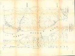
- Aerial survey map of Upper Arrow Lake
- Date
- 1954
- Is Part of
- Revelstoke Museum & Archives Maps, Plans & Drawings
- Source
- Revelstoke Museum & Archives
- Local Identifer
- A2016.118.000
- PID
- revelstoke:26446

- Title
- Columbia River and upper Arrow Lake map
- Date
- 1941
- Is Part of
- Revelstoke Museum & Archives Maps, Plans & Drawings
- Source
- Revelstoke Museum & Archives
- Local Identifer
- A2016.121.000
- PID
- revelstoke:26448
- Title
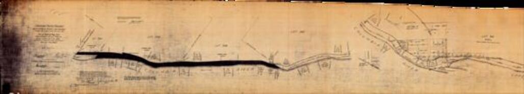
- Canadian Pacific Railway Revelstoke & Arrow Lake Branch Arrow Lake Subdivision Mile 24.5 - 28.2
- Date
- 1918
- Is Part of
- Revelstoke Museum & Archives Maps, Plans & Drawings
- Source
- Revelstoke Museum & Archives
- Local Identifer
- A2011.022.003
- PID
- revelstoke:26406
- Title
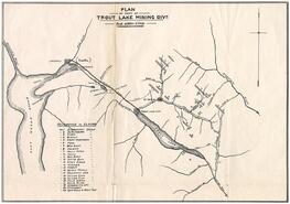
- Plan of part of Trout Lake Mining Division
- Date
- Possibly 1895
- Is Part of
- Revelstoke Museum & Archives Maps, Plans & Drawings
- Source
- Revelstoke Museum & Archives
- Local Identifer
- A2007.017.000
- PID
- revelstoke:26404

- Title
- Lot 896 G.1. 20500 Acres on Kootenay Lake Map
- Date
- n.d.
- Is Part of
- Revelstoke Museum & Archives Maps, Plans & Drawings
- Source
- Revelstoke Museum & Archives
- Local Identifer
- A2011.022.008
- PID
- revelstoke:26411

- Title
- Aerial survey map of Upper Arrow Lake region
- Date
- 1954
- Is Part of
- Revelstoke Museum & Archives Maps, Plans & Drawings
- Source
- Revelstoke Museum & Archives
- Local Identifer
- A2016.115.000
- PID
- revelstoke:26443
- Title
- Ferguson and Trout Lake with Kaslo Land Recording District
- Date
- 1927
- Is Part of
- Revelstoke Museum & Archives Maps, Plans & Drawings
- Source
- Revelstoke Museum & Archives
- Local Identifer
- A2016.122.000
- PID
- revelstoke:26449

- Title
- Trout Lake Kootenay District 82 K / 11 E
- Date
- 1966
- Is Part of
- Revelstoke Museum & Archives Maps, Plans & Drawings
- Source
- Revelstoke Museum & Archives
- Local Identifer
- A2016.159.000
- PID
- revelstoke:26481

- Title
- Kinbasket Lake Kootenay District British Columbia 82 M / 16 E
- Date
- 1964
- Is Part of
- Revelstoke Museum & Archives Maps, Plans & Drawings
- Source
- Revelstoke Museum & Archives
- Local Identifer
- A2016.175.000
- PID
- revelstoke:26493

- Title
- Plan of William Abrahamson's addition to Trout Lake City
- Date
- ca. 1900
- Is Part of
- Revelstoke Museum & Archives Maps, Plans & Drawings
- Source
- Revelstoke Museum & Archives
- Local Identifer
- A1985.030.007
- PID
- revelstoke:26332

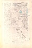
- Title
- Mabel Lake, British Columbia, West of Sixth Meridian
- Date
- 1974
- Is Part of
- Enderby and District Museum and Archives Map Collection
- Source
- Enderby and District Museum and Archives
- Local Identifer
- 1.006
- PID
- enderby:778

- Title
- Shuswap Lake British Columbia Kamloops Land District Sheet 82 L/NW
- Date
- 1959
- Is Part of
- Revelstoke Museum & Archives Maps, Plans & Drawings
- Source
- Revelstoke Museum & Archives
- Local Identifer
- A2016.151.000
- PID
- revelstoke:26475
- Title
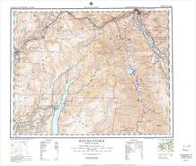
- Revelstoke British Columbia National Topographic System Sheet 82 L/NE
- Date
- 1964-1965
- Is Part of
- Revelstoke Museum & Archives Maps, Plans & Drawings
- Source
- Revelstoke Museum & Archives
- Local Identifer
- A2007.018.000
- PID
- revelstoke:26405

- Title
- Revelstoke, British Columbia National Topographical Series Topographical Map Sheet 82 L/NE
- Date
- 1950
- Is Part of
- Revelstoke Museum & Archives Maps, Plans & Drawings
- Source
- Revelstoke Museum & Archives
- Local Identifer
- A2016.125.000
- PID
- revelstoke:26452

- Title
- Revelstoke and district
- Date
- 1998
- Is Part of
- Revelstoke Museum & Archives Maps, Plans & Drawings
- Source
- Revelstoke Museum & Archives
- Local Identifer
- A2016.119.000
- PID
- revelstoke:26447
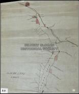
- Title
- Slocan Lake lands
- Date
- ca. 1910
- Is Part of
- Silvery Slocan Historical Society Map Collection
- Source
- Silvery Slocan Historical Society
- Local Identifer
- 3.7
- PID
- sshs:2215

- Title
- Slocan Lake Sheet 1
- Date
- 1966
- Is Part of
- Silvery Slocan Historical Society Map Collection
- Source
- Silvery Slocan Historical Society
- Local Identifer
- 7.5
- PID
- sshs:2560
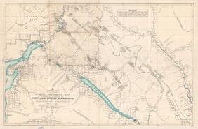
- Title
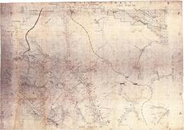
- Mineral reference map (showing surveyed claims) covering portions of Trout Lake, Lardeau & Ainsworth Mining Divisions, Kootenay District
- Date
- 1928
- Is Part of
- Revelstoke Museum & Archives Maps, Plans & Drawings
- Source
- Revelstoke Museum & Archives
- Local Identifer
- A2016.123.000
- PID
- revelstoke:26450
- Title
- Illecillewaet River (Mouth) Map 82 - L - 16 - g
- Date
- 1977
- Is Part of
- Revelstoke Museum & Archives Maps, Plans & Drawings
- Source
- Revelstoke Museum & Archives
- Local Identifer
- A2016.210.000
- PID
- revelstoke:26527