Jump to navigation
Home
Browse
About
Contact Us
Navigating & Searching
Partner Information
Login
Search Term
Advanced Search
You are here
Home
›
Views
(x)
›
Search results
Search results
Search Results
Displaying (61 - 80 of 3,689)
Pages
« first
‹ previous
…
2
3
4
5
6
…
next ›
last »
Title
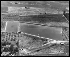
Aerial view north and south of reservoir
Date
1960
Is Part of
Greater Vernon Museum and Archives Photograph Collection
Source
Greater Vernon Museum and Archives
Local Identifer
24221
PID
gvma:24951
Title
Aerial view of southwest Vernon and part of the Commonage and sewage plant
Date
1960
Is Part of
Greater Vernon Museum and Archives Photograph Collection
Source
Greater Vernon Museum and Archives
Local Identifer
24222
PID
gvma:24952
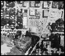
Title
Aerial view of Coldstream Avenue to 30 Avenue
Date
1970
Is Part of
Greater Vernon Museum and Archives Photograph Collection
Source
Greater Vernon Museum and Archives
Local Identifer
24224
PID
gvma:24954
Title
Aerial view of 32nd Street
Date
1970
Is Part of
Greater Vernon Museum and Archives Photograph Collection
Source
Greater Vernon Museum and Archives
Local Identifer
24225
PID
gvma:24955
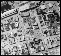
Title
Aerial view of downtown Vernon, Safeway, Eaton's
Date
1970
Is Part of
Greater Vernon Museum and Archives Photograph Collection
Source
Greater Vernon Museum and Archives
Local Identifer
24226
PID
gvma:24956
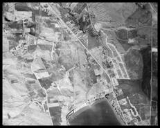
Title
Aerial view of Okanagan Landing Road, Okanagan Lake and the Commonage
Date
1970
Is Part of
Greater Vernon Museum and Archives Photograph Collection
Source
Greater Vernon Museum and Archives
Local Identifer
24227
PID
gvma:24957
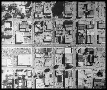
Title
Aerial view of Coldstream Avenue, Safeway, 32nd Street and 32nd Avenue
Date
1970
Is Part of
Greater Vernon Museum and Archives Photograph Collection
Source
Greater Vernon Museum and Archives
Local Identifer
24228
PID
gvma:24958
Title
Aerial map of Vernon
Date
1970
Is Part of
Greater Vernon Museum and Archives Photograph Collection
Source
Greater Vernon Museum and Archives
Local Identifer
24229
PID
gvma:24959
Title
Okanagan Landing
Date
1984
Is Part of
Greater Vernon Museum and Archives Photograph Collection
Source
Greater Vernon Museum and Archives
Local Identifer
24279
PID
gvma:25009
Title
Kalamalka Lake
Date
1984
Is Part of
Greater Vernon Museum and Archives Photograph Collection
Source
Greater Vernon Museum and Archives
Local Identifer
24280
PID
gvma:25010
Title
Okanagan Lake arms
Date
1985
Is Part of
Greater Vernon Museum and Archives Photograph Collection
Source
Greater Vernon Museum and Archives
Local Identifer
24281
PID
gvma:25011
Title
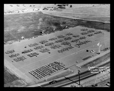
Aerial view of Camp Vernon during cadet inspection parade
Date
1967
Is Part of
Greater Vernon Museum and Archives Photograph Collection
Source
Greater Vernon Museum and Archives
Local Identifer
26955
PID
gvma:25682
Title
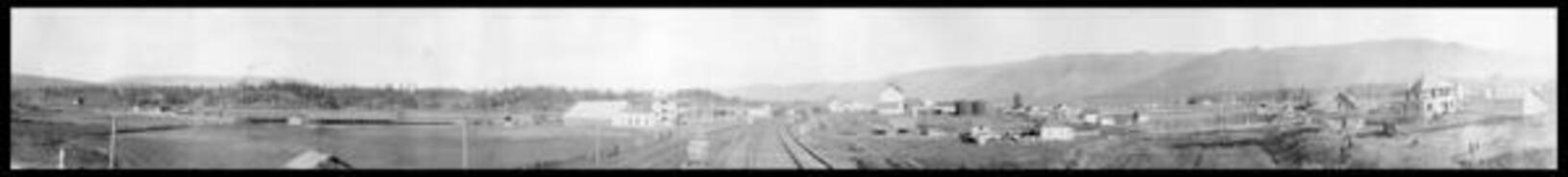
Armstrong
Date
ca. 1900
Is Part of
Greater Vernon Museum and Archives Photograph Collection
Source
Greater Vernon Museum and Archives
Local Identifer
4380
PID
gvma:2572
Title
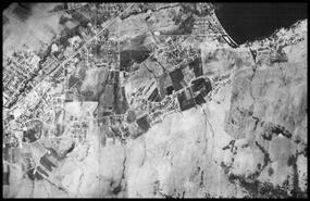
Aerial view of internment camp on Mara Lake
Date
ca. 1915
Is Part of
Greater Vernon Museum and Archives Photograph Collection
Source
Greater Vernon Museum and Archives
Local Identifer
936
PID
gvma:1162
Title
Aerial view of Pleasant Valley Road and Pleasant Valley Cemetery
Date
1964
Is Part of
Greater Vernon Museum and Archives Photograph Collection
Source
Greater Vernon Museum and Archives
Local Identifer
24171
PID
gvma:24901
Title
Aerial view of the junction of Pottery Road and Highway 6 looking northeast
Date
1964
Is Part of
Greater Vernon Museum and Archives Photograph Collection
Source
Greater Vernon Museum and Archives
Local Identifer
24172
PID
gvma:24902
Title
Aerial view of Swan Lake and BX area looking northeast
Date
1963
Is Part of
Greater Vernon Museum and Archives Photograph Collection
Source
Greater Vernon Museum and Archives
Local Identifer
24173
PID
gvma:24903
Title
North end of the City of Vernon and Swan Lake
Date
1963
Is Part of
Greater Vernon Museum and Archives Photograph Collection
Source
Greater Vernon Museum and Archives
Local Identifer
24174
PID
gvma:24904
Title
Aerial of the Pine Street Reservoir
Date
1949
Is Part of
Greater Vernon Museum and Archives Photograph Collection
Source
Greater Vernon Museum and Archives
Local Identifer
24175
PID
gvma:24905
Title
Aerial view of sewage plant construction on 43rd Street
Date
1939
Is Part of
Greater Vernon Museum and Archives Photograph Collection
Source
Greater Vernon Museum and Archives
Local Identifer
24176
PID
gvma:24906
Pages
« first
‹ previous
…
2
3
4
5
6
…
next ›
last »