Jump to navigation
Home
Browse
About
Contact Us
Navigating & Searching
Partner Information
Login
Search Term
Advanced Search
You are here
Home
›
Browse
›
Kootenay/Columbia Digitized History
›
Silvery Slocan Historical Society
›
Silvery Slocan Historical Society Map Collection
Silvery Slocan Historical Society Map Collection
Grid view
List view
Pages
1
2
3
4
5
6
7
8
9
…
next ›
last »
1896 Kaslo and Slocan Railway Plan of Location from End of Track at Sandon to Slocan Star Concentrator
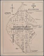
1910 Town of Silverton
1910 Town of Silverton Lot Plan Map
1920 Town of Silverton
Aerial map of New Denver
An Area near Sandon showing claim boundaries and lodge system
Ballards Plannery: plans of Western Exploration Company dwellings
Bosun Mine, Slocan Mining District, New Denver, BC
Box Lake - Rosebery Road. Plan, profile and cross-sections
C.P.R. B.C.L., and R.S., B.C. District proposed 8 car, transfer barge and Okanagan and Slocan lake
C.P.R. Lake streamers: S.S. Roseberry general plan
CPR mining map
City of Sandon map
Claim plan showing holdings of the Galena Farm Consolidated Mines Ltd.
Claims adjacent to Standard Tramway
Composite geological plan and geological sections
Copy of map received from P.Y. Gallaher
Departmental reference map, R82F/14
Dimensions of Mining Claims, Denver Flats area
Douglas mineral claim
Early Slocan Mining Camp
Early Slocan Mining Camp
East Burton Interim Topo Map 82F-13
Enterprise Mine in vertical projection
Enterprise Mine in vertical projection
Floor plan of N.D. Hospital
Four Mile creek in Silverton in Heyday
Four Mile creek in Silverton in Heyday
Fred Fraction
Geological plan: Silverton Area Slocan Mining Camp BC, NE sheet of 4 sheets
Geological survey: Structure sections of the Slocan series.
Government reserve, mouth of Carpenter Creek
Pages
1
2
3
4
5
6
7
8
9
…
next ›
last »
Details
Title
Silvery Slocan Historical Society Map Collection
Creator
Subject
Description
Publisher
Contributor
Date
1892-2006
Type
collections (object groupings), Collection
Format
electronic, 30 maps, plans, or drawings
Identifier
sshs:maps
Source
Language
English
Relation
Silvery Slocan Historical Society--sshs:root
Coverage
1892-2006
Rights
Images provided for research and reference use only. Permission to publish, copy, or otherwise use these images must be obtained from the Silvery Slocan Historical Society: silveryslocanhs[at]gmail.com, http://rightsstatements.org/vocab/CNE/1.0/