Search results

Search Results
Displaying (61 - 80 of 646)
Pages

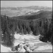
- Title
- Aerial view of Trail and the smelter, 1960s
- Date
- 1960s
- Is Part of
- Trail Historical Society Photograph Collection
- Source
- Trail Historical Society
- Local Identifer
- Cat. No. 12702
- PID
- trail:2301

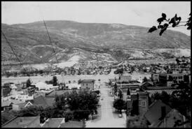
- Title
- Trail, B.C.
- Date
- 1913
- Is Part of
- Trail Historical Society Photograph Collection
- Source
- Trail Historical Society
- Local Identifer
- Cat. No. 0026
- PID
- trail:23
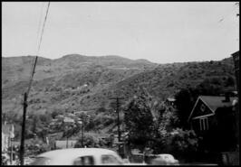
- Title
- View of Trail taken from the Rossland-Sheep Lake Road, now Highway 3B
- Date
- 1968
- Is Part of
- Trail Historical Society Photograph Collection
- Source
- Trail Historical Society
- Local Identifer
- Cat. No. 12703
- PID
- trail:2302

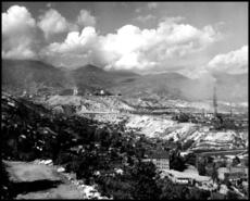
- Title
- View of Trail taken from the smelter showing downtown and the bridge, 1930s
- Date
- 1930s
- Is Part of
- Trail Historical Society Photograph Collection
- Source
- Trail Historical Society
- Local Identifer
- Cat. No. 12769
- PID
- trail:2216
- Title
- Downtown Trail from Columbia Heights looking down Eldorado Street towards East Trail, 1930s
- Date
- 1930s
- Is Part of
- Trail Historical Society Photograph Collection
- Source
- Trail Historical Society
- Local Identifer
- Cat. No. 12877
- PID
- trail:2133

- Title
- Trail from above Columbia Heights, 1940s
- Date
- 1940s
- Is Part of
- Trail Historical Society Photograph Collection
- Source
- Trail Historical Society
- Local Identifer
- Cat. No. 12700
- PID
- trail:2299

- Title
- Street scene showing the bridge from Columbia Heights looking south over downtown Trail, 1930s
- Date
- 1930s
- Is Part of
- Trail Historical Society Photograph Collection
- Source
- Trail Historical Society
- Local Identifer
- Cat. No. 12878
- PID
- trail:2134
- Title
- Looking south from downtown Trail, 1930s
- Date
- 1930s
- Is Part of
- Trail Historical Society Photograph Collection
- Source
- Trail Historical Society
- Local Identifer
- Cat. No. 12873
- PID
- trail:2129

- Title
- Lady Columbia' taken from Kootenay Columbia Mountain in Rossland, B.C.
- Date
- n.d.
- Is Part of
- Trail Historical Society Photograph Collection
- Source
- Trail Historical Society
- Local Identifer
- Cat. No. 12754
- PID
- trail:2226

- Title
- View of Trail taken from the bank below the smelter, 1960s
- Date
- 1960s
- Is Part of
- Trail Historical Society Photograph Collection
- Source
- Trail Historical Society
- Local Identifer
- Cat. No. 12706
- PID
- trail:2305

- Title
- View of Trail and smelter taken from above Sunningdale looking south-west, 1960s
- Date
- 1960s
- Is Part of
- Trail Historical Society Photograph Collection
- Source
- Trail Historical Society
- Local Identifer
- Cat. No. 12707
- PID
- trail:2306

- Title
- View of Trail from Lookout Mountain, looking north over old bridge toward the smelter, 1940s
- Date
- 1940s
- Is Part of
- Trail Historical Society Photograph Collection
- Source
- Trail Historical Society
- Local Identifer
- Cat. No. 12709
- PID
- trail:2308

- Title
- Taken where Riverview Motors is located now in Glenmerry, 1940s
- Date
- 1940s
- Is Part of
- Trail Historical Society Photograph Collection
- Source
- Trail Historical Society
- Local Identifer
- Cat. No. 12601
- PID
- trail:2406

- Title
- View of smelter from Riverside Avenue during the 1948 flood
- Date
- 1948
- Is Part of
- Trail Historical Society Photograph Collection
- Source
- Trail Historical Society
- Local Identifer
- Cat. No. 12642
- PID
- trail:2310

- Title
- View of the smelter and Columbia River taken during the 1948 flood from above Riverside Avenue
- Date
- 1948
- Is Part of
- Trail Historical Society Photograph Collection
- Source
- Trail Historical Society
- Local Identifer
- Cat. No. 12643
- PID
- trail:2311

- Title
- View of Trail taken above south-end of Cedar Avenue from Columbia Heights, 1960s
- Date
- 1960s
- Is Part of
- Trail Historical Society Photograph Collection
- Source
- Trail Historical Society
- Local Identifer
- Cat. No. 12708
- PID
- trail:2307

- Title
- View of Trail from Lookout Mountain showing the smelter in the background and construction of the riverwall, 1950s
- Date
- 1950s
- Is Part of
- Trail Historical Society Photograph Collection
- Source
- Trail Historical Society
- Local Identifer
- Cat. No. 12705
- PID
- trail:2304
- Title
- View of Trail, the smelter and fertilizer plant in Warfield, 1950s
- Date
- 1950s
- Is Part of
- Trail Historical Society Photograph Collection
- Source
- Trail Historical Society
- Local Identifer
- Cat. No. 12704
- PID
- trail:2303

- Title
- Postcard of Trail and smelter with Merry Christmas Happy New Year, 1960s
- Date
- 1960s
- Is Part of
- Trail Historical Society Photograph Collection
- Source
- Trail Historical Society
- Local Identifer
- Cat. No. 12757
- PID
- trail:2229

- Title
- Eric Atwood looking over the valley in which he owns considerable acreage
- Date
- ca. 1942
- Is Part of
- Trail Historical Society Photograph Collection
- Source
- Trail Historical Society
- Local Identifer
- Cat. No. 13167
- PID
- trail:2432