Jump to navigation
Home
Browse
About
Contact Us
Navigating & Searching
Partner Information
Login
Search Term
Advanced Search
You are here
Home
›
lake country museum
(x)
›
map
(x)
›
Search results
Search results
Search Results
Displaying (81 - 100 of 368)
Pages
« first
‹ previous
…
3
4
5
6
7
…
next ›
last »
Title
Plan Showing Relative Position of Certain Mines
Date
1980
Is Part of
Silvery Slocan Historical Society Map Collection
Source
Silvery Slocan Historical Society
Local Identifer
4.12
PID
sshs:2221
Title
Interim Map 82 F/14f
Date
1967
Is Part of
Silvery Slocan Historical Society Map Collection
Source
Silvery Slocan Historical Society
Local Identifer
7.1
PID
sshs:2556
Title
Plan showing right of way for road through part of Block Y of L. 384 as shown on map No. 1365, Kootenay District, B.C.
Date
1953
Is Part of
Revelstoke Museum & Archives Maps, Plans & Drawings
Source
Revelstoke Museum & Archives
Local Identifer
A2011.022.010
PID
revelstoke:26413
Title
Public Works of Canada Site of Wharf at Arrowhead, BC
Date
1953
Is Part of
Revelstoke Museum & Archives Maps, Plans & Drawings
Source
Revelstoke Museum & Archives
Local Identifer
A2011.022.009
PID
revelstoke:26412
Title
Map of Kaslo City
Date
1891
Is Part of
Kootenay Lake Historical Society Maps & Plans Collection
Source
Kootenay Lake Historical Society
PID
klhs:2191
Title
Plan of Township 19 Range 9 West of the Sixth Meridian
Date
1890
Is Part of
Enderby and District Museum and Archives Map Collection
Source
Enderby and District Museum and Archives
Local Identifer
8.024
PID
enderby:3187
Title
District of Peachland - Legal Base Map
Date
2004
Is Part of
Peachland Museum Map Collection
Source
Peachland Museum
Local Identifer
PEAC_13_01_ed.tif
PID
peach:1036
Title
Okanagan Connector
Date
1987
Is Part of
Peachland Museum Map Collection
Source
Peachland Museum
Local Identifer
PEAC_13_02_ed.tif
PID
peach:1037
Title
Trepanier creek dam for domestic water
Date
1930
Is Part of
Peachland Museum Map Collection
Source
Peachland Museum
Local Identifer
PEAC_13_10_ed.tif
PID
peach:1043
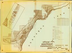
Title
Official Peachland Community Plan
Date
1981
Is Part of
Peachland Museum Map Collection
Source
Peachland Museum
Local Identifer
PEAC_13_11_ed.tif
PID
peach:1044
Title
5th Street
Date
n.d.
Is Part of
Peachland Museum Map Collection
Source
Peachland Museum
Local Identifer
PEAC_13_06_ed.tif
PID
peach:1049
Title
Grave Site Plan, Peachland Cemetery
Date
2001
Is Part of
Peachland Museum Map Collection
Source
Peachland Museum
Local Identifer
PEAC_13_07_ed.tif
PID
peach:1050
Title
Plan 125 Road - Hamilton, Vint, Grant
Date
1928
Is Part of
Peachland Museum Map Collection
Source
Peachland Museum
Local Identifer
PEAC_13_08_ed.tif
PID
peach:1051
Title
Major Street Network Peachland
Date
1982
Is Part of
Peachland Museum Map Collection
Source
Peachland Museum
Local Identifer
PEAC_13_09_ed.tif
PID
peach:1052
Title
Merritt to Peachland Highway
Date
1985
Is Part of
Peachland Museum Map Collection
Source
Peachland Museum
Local Identifer
PEAC_13_03
PID
peach:1048
Title
Municipality of Summerland B.C.
Date
1918
Is Part of
Summerland Museum and Archives Map Collection
Source
Summerland Museum and Archives
Local Identifer
981-144-24
PID
summer:2754
Title
Municipality of Summerland B.C.
Date
1918
Is Part of
Summerland Museum and Archives Map Collection
Source
Summerland Museum and Archives
Local Identifer
982-378
PID
summer:2758
Title
K.V.R. West Summerland Station Bill of Material
Date
1916
Is Part of
Summerland Museum and Archives Map Collection
Source
Summerland Museum and Archives
Local Identifer
987-110-2
PID
summer:2761
Title
Map of Portion of Yale District British Columbia
Date
1906
Is Part of
Summerland Museum and Archives Map Collection
Source
Summerland Museum and Archives
Local Identifer
978-565-1
PID
summer:2771
Title
Summerland: Key Map
Date
1909
Is Part of
Summerland Museum and Archives Map Collection
Source
Summerland Museum and Archives
Local Identifer
979-28-2d
PID
summer:2773
Pages
« first
‹ previous
…
3
4
5
6
7
…
next ›
last »