Jump to navigation
Home
Browse
About
Contact Us
Navigating & Searching
Partner Information
Login
Search Term
Advanced Search
You are here
Home
›
Mining
(x)
›
map
(x)
›
Search results
Search results
Search Results
Displaying (101 - 120 of 120)
Pages
« first
‹ previous
…
2
3
4
5
6
Title
Sandon mining claims
Date
n.d.
Is Part of
Silvery Slocan Historical Society Map Collection
Source
Silvery Slocan Historical Society
Local Identifer
4.35
PID
sshs:2541
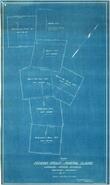
Title
Dimensions of Mining Claims, Denver Flats area
Date
n.d.
Is Part of
Silvery Slocan Historical Society Map Collection
Source
Silvery Slocan Historical Society
Local Identifer
4.36
PID
sshs:2542
Title
Mining claims
Date
n.d.
Is Part of
Silvery Slocan Historical Society Map Collection
Source
Silvery Slocan Historical Society
Local Identifer
4.37
PID
sshs:2543
Title
Mining claims
Date
n.d.
Is Part of
Silvery Slocan Historical Society Map Collection
Source
Silvery Slocan Historical Society
Local Identifer
4.38
PID
sshs:2544
Title
Mining roads and Claims, Idaho and Cumberland
Date
1971
Is Part of
Silvery Slocan Historical Society Map Collection
Source
Silvery Slocan Historical Society
Local Identifer
4.39
PID
sshs:2545
Title
Perry's Mining map of the Southern District, West Kootenay
Date
1893
Is Part of
Silvery Slocan Historical Society Map Collection
Source
Silvery Slocan Historical Society
Local Identifer
4.41
PID
sshs:2546
Title
Plan showing relative position of certain mines
Date
1897
Is Part of
Silvery Slocan Historical Society Map Collection
Source
Silvery Slocan Historical Society
Local Identifer
4.13
PID
sshs:2604
Title
The Slocan early claims map
Date
1897
Is Part of
Silvery Slocan Historical Society Map Collection
Source
Silvery Slocan Historical Society
Local Identifer
4.9
PID
sshs:2605
Title
Plan of right-of-way for proposed aerial tram, Silversmith Mines, Ltd., Sandon, BC
Date
1921
Is Part of
Silvery Slocan Historical Society Map Collection
Source
Silvery Slocan Historical Society
Local Identifer
5.71
PID
sshs:2607
Title
Plan of right of way for flume line and tramway of Standard Silver-Lead Mining Co., Kootenay District, 1912
Date
1912
Is Part of
Silvery Slocan Historical Society Map Collection
Source
Silvery Slocan Historical Society
Local Identifer
9.12
PID
sshs:2587
Title
Four Mile creek in Silverton in Heyday
Date
1985
Is Part of
Silvery Slocan Historical Society Map Collection
Source
Silvery Slocan Historical Society
Local Identifer
14.6
PID
sshs:2597
Title
Four Mile creek in Silverton in Heyday
Date
1985
Is Part of
Silvery Slocan Historical Society Map Collection
Source
Silvery Slocan Historical Society
Local Identifer
14.7
PID
sshs:2598
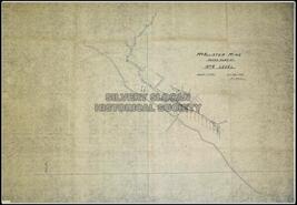
Title
McAllister Mine assay plan of no. 4 level
Date
1935
Is Part of
Silvery Slocan Historical Society Map Collection
Source
Silvery Slocan Historical Society
Local Identifer
6.6
PID
sshs:2563
Title
Plan showing Right of Way for flume line
Date
1930
Is Part of
Silvery Slocan Historical Society Map Collection
Source
Silvery Slocan Historical Society
Local Identifer
7.8
PID
sshs:2564
Title
Early Slocan Mining Camp
Date
1985
Is Part of
Silvery Slocan Historical Society Map Collection
Source
Silvery Slocan Historical Society
Local Identifer
14.9
PID
sshs:2599
Title
Plan of part of Trout Lake Mining Division
Date
Possibly 1895
Is Part of
Revelstoke Museum & Archives Maps, Plans & Drawings
Source
Revelstoke Museum & Archives
Local Identifer
A2007.017.000
PID
revelstoke:26404
Title
Plan showing surveyed claims property of the Mastodon Mining Co. Ltd., Revelstoke Mining Division, West Kootenay District, B.C.
Date
ca. 1929
Is Part of
Revelstoke Museum & Archives Maps, Plans & Drawings
Source
Revelstoke Museum & Archives
Local Identifer
A2011.022.013
PID
revelstoke:26416
Title
Plan of Jenkins Group of Mineral Claims, Lardeau Mining Division Kootenay District, B.C.
Date
1929
Is Part of
Revelstoke Museum & Archives Maps, Plans & Drawings
Source
Revelstoke Museum & Archives
Local Identifer
A2011.022.007
PID
revelstoke:26410
Title
Graphic report of the Mastodon Mineral Group, Big Bend District, B.C.
Date
1933
Is Part of
Revelstoke Museum & Archives Maps, Plans & Drawings
Source
Revelstoke Museum & Archives
Local Identifer
A2011.022.014
PID
revelstoke:26417
Title
Plan showing possible routes for road Up Carnes Creek to Mastodon Mine
Date
1935
Is Part of
Revelstoke Museum & Archives Maps, Plans & Drawings
Source
Revelstoke Museum & Archives
Local Identifer
A2011.022.017a
PID
revelstoke:26420
Pages
« first
‹ previous
…
2
3
4
5
6