Jump to navigation
Home
Browse
About
Contact Us
Navigating & Searching
Partner Information
Login
Search Term
Advanced Search
You are here
Home
›
Lakes & ponds
(x)
›
Okanagan Falls Heritage Museum & Bassett House
(x)
›
map
(x)
›
Search results
Search results
Search Results
Displaying (1 - 20 of 24)
Pages
1
2
next ›
last »
Title
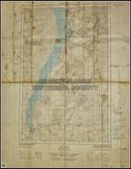
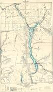
Lower Slocan Lake from New Denver to Slocan City
Date
1963
Is Part of
Silvery Slocan Historical Society Map Collection
Source
Silvery Slocan Historical Society
Local Identifer
1.6
PID
sshs:2120
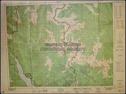
Title
Rosebery 82k/3
Date
1979
Is Part of
Silvery Slocan Historical Society Map Collection
Source
Silvery Slocan Historical Society
Local Identifer
1.8
PID
sshs:2122
Title
Slocan 82f/14
Date
ca. 1981
Is Part of
Silvery Slocan Historical Society Map Collection
Source
Silvery Slocan Historical Society
Local Identifer
1.1
PID
sshs:2152
Title
Map 82 K/4, E, 1/2
Date
1959
Is Part of
Silvery Slocan Historical Society Map Collection
Source
Silvery Slocan Historical Society
Local Identifer
1.11
PID
sshs:2153
Title
Map 82, K/3 W- Slocan Lake
Date
1954
Is Part of
Silvery Slocan Historical Society Map Collection
Source
Silvery Slocan Historical Society
Local Identifer
1.12
PID
sshs:2154
Title
Map 82 F/14 W Slocan (South Slocan lake)
Date
1954
Is Part of
Silvery Slocan Historical Society Map Collection
Source
Silvery Slocan Historical Society
Local Identifer
1.13
PID
sshs:2155
Title
Map 82 K/3 E
Date
1954
Is Part of
Silvery Slocan Historical Society Map Collection
Source
Silvery Slocan Historical Society
Local Identifer
1.14
PID
sshs:2156
Title
East Burton Interim Topo Map 82F-13
Date
1954
Is Part of
Silvery Slocan Historical Society Map Collection
Source
Silvery Slocan Historical Society
Local Identifer
1.15
PID
sshs:2157
Title
Slocan, Kootenay District, BC
Date
1966
Is Part of
Silvery Slocan Historical Society Map Collection
Source
Silvery Slocan Historical Society
Local Identifer
1.16
PID
sshs:2158
Title
Slocan Lake lands
Date
ca. 1910
Is Part of
Silvery Slocan Historical Society Map Collection
Source
Silvery Slocan Historical Society
Local Identifer
3.7
PID
sshs:2215
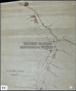
Title
Sketch map of the Slocan Lake District, March 1896
Date
1896
Is Part of
Silvery Slocan Historical Society Map Collection
Source
Silvery Slocan Historical Society
Local Identifer
4.4
PID
sshs:2443
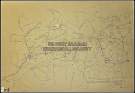
Title
Sketch map of the Slocan Lake District
Date
1896
Is Part of
Silvery Slocan Historical Society Map Collection
Source
Silvery Slocan Historical Society
Local Identifer
4.5
PID
sshs:2446
Title
Slocan Lake Sheet 1
Date
1966
Is Part of
Silvery Slocan Historical Society Map Collection
Source
Silvery Slocan Historical Society
Local Identifer
7.5
PID
sshs:2560
Title
Sketch map of the Slocan Lake District, March 1896
Date
1896
Is Part of
Silvery Slocan Historical Society Map Collection
Source
Silvery Slocan Historical Society
Local Identifer
4.3
PID
sshs:2536
Title
Lot 896 G.1. 20500 Acres on Kootenay Lake Map
Date
n.d.
Is Part of
Revelstoke Museum & Archives Maps, Plans & Drawings
Source
Revelstoke Museum & Archives
Local Identifer
A2011.022.008
PID
revelstoke:26411
Title
Plan showing right of way for road through part of Block Y of L. 384 as shown on map No. 1365, Kootenay District, B.C.
Date
1953
Is Part of
Revelstoke Museum & Archives Maps, Plans & Drawings
Source
Revelstoke Museum & Archives
Local Identifer
A2011.022.010
PID
revelstoke:26413
Title
Aerial survey map of Upper Arrow Lake region
Date
1954
Is Part of
Revelstoke Museum & Archives Maps, Plans & Drawings
Source
Revelstoke Museum & Archives
Local Identifer
A2016.115.000
PID
revelstoke:26443
Title
Aerial survey map of Upper Arrow Lake
Date
1954
Is Part of
Revelstoke Museum & Archives Maps, Plans & Drawings
Source
Revelstoke Museum & Archives
Local Identifer
A2016.118.000
PID
revelstoke:26446
Title
Arrowhead sheet map No. 4 H
Date
1926
Is Part of
Revelstoke Museum & Archives Maps, Plans & Drawings
Source
Revelstoke Museum & Archives
Local Identifer
A2016.124.000
PID
revelstoke:26451
Title
Shuswap Lake British Columbia Kamloops Land District Sheet 82 L/NW
Date
1959
Is Part of
Revelstoke Museum & Archives Maps, Plans & Drawings
Source
Revelstoke Museum & Archives
Local Identifer
A2016.151.000
PID
revelstoke:26475
Pages
1
2
next ›
last »